
Soil erosion has caused profound damage to the Icelandic ecosystem, and it is a problem likely to be exacerbated by future climate warming.
In 2019, a research team led by Newcastle University’s Dr Nick Cutler set out to better understand the role that localized soil moisture levels play in the erosion of escarpment features in Hamragar√∞ahei√∞i, South Iceland.
The team hypothesised that plants close to existing areas of erosion would be more stressed than those at distance, and that this stress would be mainly driven by soil moisture availability and behaviour (wetting and drying cycles).
They therefore reasoned that expansion of the eroded areas would likely be accelerated by these less healthy (stressed) proximal plants providing less capacity to retard erosion – resulting in a destructive feedback mechanism.
The experiment
To test their theories, the team installed nine SM150T soil moisture and temperature sensors at a rofabard (erosion escarpment) where they had been closely monitoring erosion activity since 2014.
This rofabard featured a relatively flat surface covered with a vegetation cover of mossy forb meadow and moderately well-developed earth hummocks.
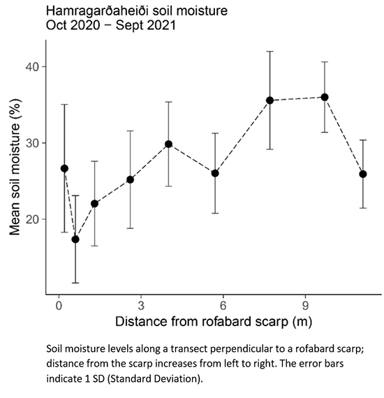
A transect 11.10 meters long from the eroding edge into the centre of the rofabard was established, as depicted in image below.
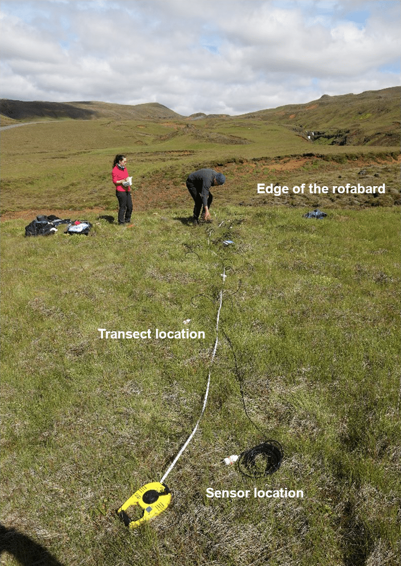
The SM150T soil sensors were then positioned at points along the transect – within hollows between hummocks, to measure soil moisture content towards the eroding slope.
Installation of the SM150T sensors
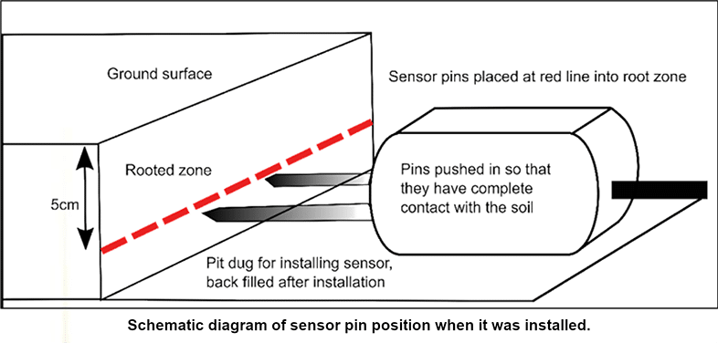
The research team removed a small block of turf at all measurement points along the transect – enabling them to install each sensor horizontally at a depth 5 cm – see image below.
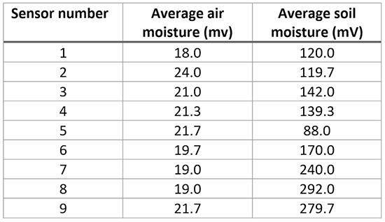
The team then used a SM150 moisture sensor kit (with instant readout unit) to take three soil moisture measurements at the precise location of each newly buried sensor – the averaged figure (of the three readings) acting as reference data specific to the time of installation – see table below.
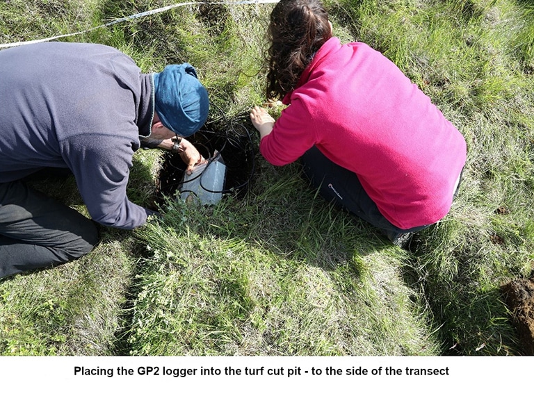
Once in place, the sensors were then completely covered by the previously removed turf blocks.
The cables from the sensors (leading to a Delta-T Devices GP2 Data Logger) were buried within a slot cut into the turf – so that they were all also completely hidden, and the GP2 Data Logger itself was also buried under turf – see image below.
The measurement process and results
The SM150T and GP2 logger network successfully collected moisture data over a period of 21 months – with a total of 15,095 measurements made by each sensor.
A summary of moisture data can be seen below.
Conclusions from the research team
Project leader Dr Nick Cutler said,
“The deployment of SM150T Soil Moisture Sensors on the Hamragar√∞ahei√∞i site was a huge success, and we retrieved pretty much complete measurements of soil moisture and temperature from the 9th of September 2019 to 19th May 2021.”
He continued,
“The data shows that mean annual soil moisture levels varied by a factor of 2, from 17 and 36% (quite a big difference over a distance of just 11 m).
The readings from the probe nearest the rofabard scarp (far left-hand side of chart above) are higher than we expected, and this sensor also showed the highest variability is soil moisture. This may be due to driving rain penetration on the scarp face and rapid drying of the exposed sediment.
The data are noisy, but, crucially, there does appear to be an increase in soil moisture with distance from the scarp, as we anticipated.”
Visit the SM150T Soil Sensor web page